Wreck diving on Espiritu Santo, Vanuatu

dive14

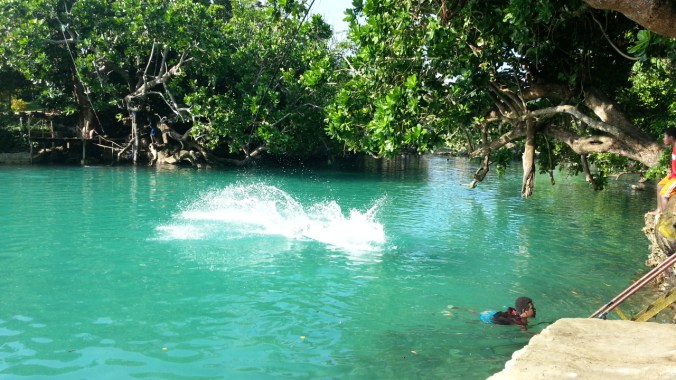
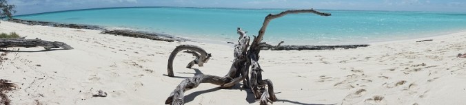
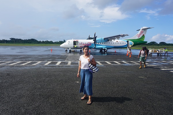
We wanted to explore other parts of Vanuatu apart from Efate Island. Espirito Santo was recommended to us by friends of Lu and Tim (the friends we are staying with on Efate).  It is particularly well known for its scuba diving, which we want to do more of –  so we took a small plane from Port Villa and just over an hour later, we arrived in Luganville, Santo’s capital, and Vanuatu’s second biggest town.

dive12

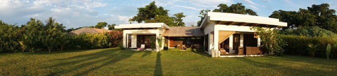
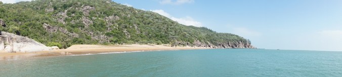
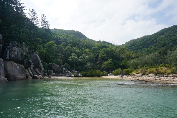
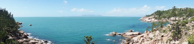
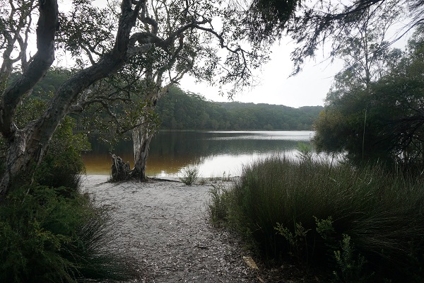
A taxi met us and took us up to our hotel, Deco Stop sits on a hill above Luganville. The hotel is a very cool and relaxing spot. The design is inspired by traditional Vanuatan architecture and decorated with traditional art. The name ‘Deco Stop’ references the scuba diving term ‘decompression stop’ which gives a clue to the clientele they attract! It is run by a lovely Australian couple Kim and Ben and staffed by local women who serve up super fresh local food. There’s a huge covered area which incorporates a deck with pool, seating areas and restaurant, all looking out over the South Pacific with Aore Island on the other side of the bay.

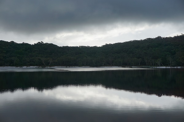
Unfortunately the views were obscured on the first night when a heavy rainstorm hit. Undeterred, David got on the phone and booked a couple of scuba dives for the next day. Looking out over the rain swept bay, I  wondered privately if we should have stayed on Efate. Would the sun come out or would our dives be rained off?

That night I found it hard to sleep. The bed was comfortable but the wildlife on Santo was in full throat, especially the dogs. Just as I dropped into a deep sleep, I was woken by someone shaking me. No, someone was shaking the bed. I turned to David and found him looking at me in alarm. No one was shaking the bed. It was an earthquake!! Fortunately, it was over in a few seconds. Still, it was a shock and a tiny taste of Vanuatu’s reputation as a dangerous place to live owing to the frequency of natural disasters – earthquakes, cyclones, volcanic eruptions. This combined with a lack of water, sanitation and resources to deal with emergencies have put it at the top of the United Nations most ‘at risk’ places in the world. As I write this, the people of Ambae Island are being taken from their homes and resettled on neighbouring islands due to the eruption of Manaro volcano.

dive13

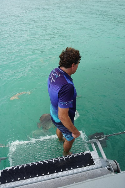
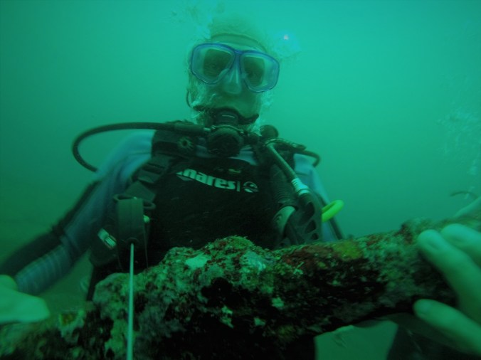
The next morning dawned bright, if somewhat cloudy, and we were picked up from the hotel at 8 am by Scott and David of Pacific Dive. Scott is the very youthful owner of this great dive shop which is based at the Espiritu Hotel in Luganville. He is fortunate to have David as part of his team – David is a very experienced instructor, a Ni-Van (the local term for all Melanesian ethnicities originating in Vanuatan) who has been diving on Santo for 30 years.

DCIM100GOPRO

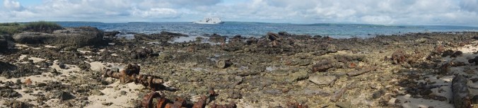
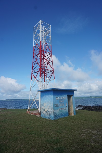
Our first destination was Million Dollar Point. At the end of World War II, the Americans couldn’t decide what to do with all their machinery – the trucks, the cranes, the tanks. They offered it to the French and the English for a knockdown bargain price but they both refused, reasoning that the Americans would leave it behind anyway and then they could have it for free. Picqued, the Americans made the decision to spite the French and the English and bulldozer the whole lot into the sea. A scene of waste and environmental destruction which shocked the residents of Santo and is still shocking today.

dive9.JPG

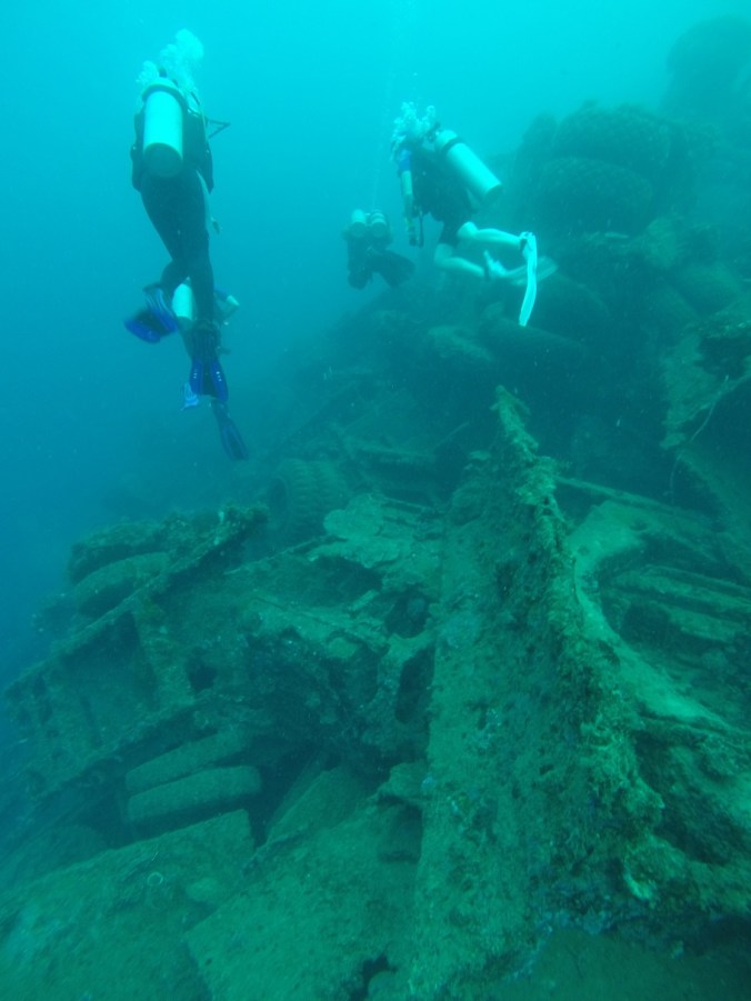
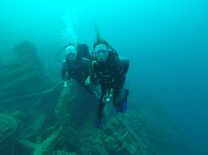
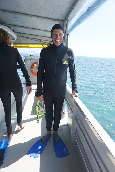
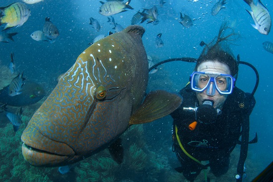
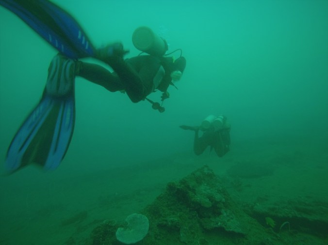
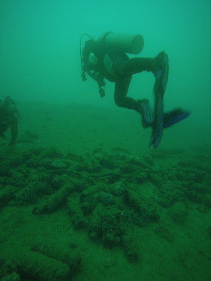
We put on our diving gear and sank down into the water to have a look at it all. Almost immediately, we found ourselves diving amongst upturned trucks and tanks. The ocean has covered the metal in coral and fish swim amongst the guns. It was my first taste of diving on wrecks, and I found it fascinating and ever so slightly scary.

DCIM100GOPRO

After the dive, we went back to Deco Stop for lunch. After lunch, we were picked up for our second dive, a wreck dive on the SS President Coolidge. Unfortunately due to a mix up we found that we had been picked up by the wrong dive operator, Allan Power and not Pacific Dive.  Allan Power has achieved almost God like status in dive circles, having been diving on the Coolidge for thirty years –  but his language when he realised what had happened was entirely human!  Alan Powers dropped us off at our dive site and gave Pacific Dive a call to let them know where we were.

dive15

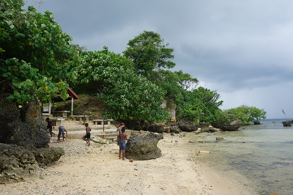
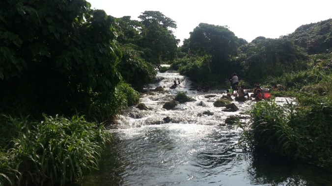
While we waited for our guys, we played with some local kids who were on the beach.  David skimmed stones, which they thought was very impressive. Then I started to search for shells and sea glass and they joined in. We decorated a rock with a garden of shells and sea glass. Pacific Dive turned up and we got kitted up to dive the Coolidge –  probably the most famous wreck dive in the world.

DCIM100GOPRO


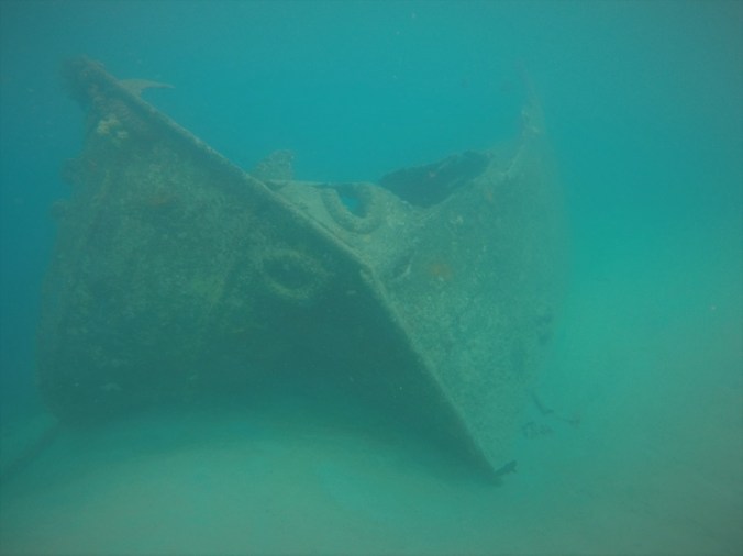
The Coolidge started life in 1931 as a luxury liner. It was converted to transport troops in 1941. In 1942 she sailed into Luganville Harbour, unaware that the entire harbour had been mined as a defensive measure against Japanese ships. The first mine hit the engine room and killed one man, Fireman Robert Reid, instantly. A second mine hit the boat a few minutes later. The Captain ran the ship aground and immediately evacuated the ship. All 5,340 men got ashore safely, except for a handful who were stuck in the infirmary. Captain Euart returned through one of the sea doors and successfully rescued the men, but before he could get out the ship listed over and he went down with the ship. His body was not recovered until 2014, when it transported to America and buried with full military honours.

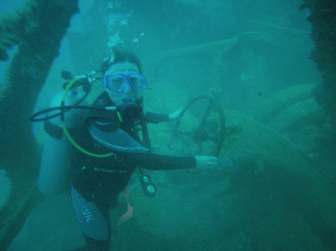
I was nervous about doing the dive, which was deep – in places as low as 30 metres (about 100 feet), a good 10 metres lower than we’ve dived before.  Almost as soon as we went down, we were swimming over the boat. I suddenly realised that the circular shape I was looking down on was a porthole. I swam down and rubbed the glass with my hand. I half expected a face to appear at the window. (Swimming over piles of live ammunition was also disconcerting!)

DCIM100GOPRO

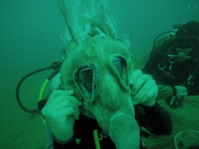
As we explored the deck, we came across a large cooking pot filled with gas masks, helmets and a portable radio. Alongside the cooking pot lay a collection of rifles. They were covered in rust and barnacles but were still recognisably guns. The soldiers had planned to return to the boat and recover their possessions but they never did.Next we passed a large machine gun and saw huge shells standing ready on a rack.

DCIM100GOPRO

David, our dive instructor, suddenly dropped off the edge of the boat and beckoned me to follow. As I went down after him, I had a real sense of how deep we were. It was far more dark and much, much more spooky! “Like, yikes! A haunted wreck!” We checked out a couple of cargo holds and then began to ascend again. Like, phew!

DCIM100GOPRO

Back on dry land, I was filled with a sense of achievement. I had done a wreck dive – and dived to 30 metres. We had only just scraped the surface, of course. The Coolidge is the largest wreck in the world with many amazing features which we didn’t go anywhere near deep enough to see.  However, as an inexperienced diver, I found it a wonderful introduction to wreck diving  – and a sight which will haunt my dreams.

DCIM100GOPRO

The Blue Lagoon, Efate, Vanuatu

dol7

Lu offered to drive us around to the other side of the island to visit the Blue Lagoon. We headed off around the circular road which goes right round the island (a distance of around 122 kilometres.) The road sustained serious damage during Cyclone Pam and in places is still in a bad way. Repairs are slowly taking place –  but something tells me it’s going to be sometime before work is completed. So, we bumped along and were thankful that Lu had a four wheel drive.

Along the way we passed groups of locals walking along the road. They were very friendly, shouting and waving and barking at Hilltop (Lu’s dog), who had her head stuck out the window to catch the breeze as we drove along.

We drove through lots of small villages which mainly consisted of simple huts made of wood with a thatched roof. The huts can easily be taken down in a Cyclone and then rebuilt again. Churches and schools are more substantial builds and often provide shelter in an emergency.  Many villages have a small shop and all of them have a Kava bar or two. Kava is the traditional local drink which is sold by the ‘shell’. There is plenty of local folklore surrounding Kava. It is said to have hallucinogenic properties but I can’t comment as I haven’t tried it. If I do, I promise I’ll let you know. Prince Charles was here last week and he is reported to have necked down three shells which has earned him some kudos!

We passed a World War II museum. A sign outside read ‘Rust in Peace’. I was keen to take a look but apparently it’s not much more than a few old coke bottles and some rusty metal.

blu3

We stopped for a lunch at Orovy, a locally run restaurant which was right on the beach. It had fantastic views over the islands of Nguna, Pele and the mountainous Mataso. Lunch was freshly caught fish washed down with fresh coconuts cut straight ‘to order’ from the tree.

After lunch, it was back on the road. After clunking over a dangerous looking bridge which looked to be a relic from World War II, we spotted a large rusty metal frame buried in the undergrowth which Lu said was an old aircraft hanger. This part of the island was largely taken over by American soldiers in the war.

We soon passed over a beautiful river. We stopped to watch some locals messing about and having fun whilst doing the washing.

blu2

Finally we arrived at the Blue Lagoon and paid a small fee to get in. It’s a jaw-droppingly bright blue water hole which looks like a swimming pool but is totally natural. A fresh water spring feeds the hole from one end and the sea feeds it from the other. The result is a pool which at low tide is fresh water but at high tide is predominantly salt water. A clutch of local teenage girls were dancing to a stereo and taking selfies. The boys were hurling themselves into the water, swinging from the trees or jumping from ropes. Never one to resist the pull of a rope swing I joined the queue and ended up doing an undignified belly-flop. In my defence, it’s not as easy as it looks!

20180427_152230

Hilltop was watching anxiously from the side, so Lu encouraged her in and eventually she jumped in and joined us. David and I then took a long swim through the lagoon towards the sea. It was beautiful all the way with trees studded with orchids and pretty flowering bushes. We came within about 100 metres of the sea and then stopped – the sea is quite rough on this side compared to Havannah Harbour –  and the surf was up.

20180427_152323

When we got back to the house, we were tired, but it was such a beautiful evening that Lu and I decided to head out for a snorkel. Hilltop was keen to join us so Lu loaded her onto a kayak and she came out too. I now understand why she is known as the most famous dog on the island!

DCIM100GOPRO

Havannah Harbour, Efate, Vanuatu


dol8

We have bid farewell to Australia and we’re now in Vanuatu, staying with Lu (or Lulu as she’s known by locals!) an old school friend, who happens to live in this amazing, out the way place. Vanuatu is an archipelago of over 80 islands in the South Pacific. Lu lives on Efate Island in Havannah Harbour, a beautiful spot about 30 km North of Port Vila, the capital city.

Lu picked us up from the airport and drove us to the house which she and her partner Tim built. It’s right on the beach, with amazing views over Havannah Harbour towards Moso and Lelepa Islands. These islands create a wonderfully sheltered bay, perfect for boating. It’s hard to believe, as I sit here looking over the peaceful and deserted bay, but during the Second World War, it was home to an entire fleet of the U.S. navy. They came here after Pearl Harbour.  An airstrip was constructed where Lu and Tim’s house stands now. Apparently, pieces of green glass from wartime coke bottles wash up on the shore to this day.

dol5

Vanuatu was badly affected by Cyclone Pam in 2015, which in some areas wiped out 95% of buildings, crops and plantations. Lu and the other overseas residents and visitors of Efate were very involved in efforts to get food, shelter and water to those worst affected. It was obviously a terrible time. However, it did have an upside in that it brought people closer together. Lu seems to know everyone in the neighbourhood. Two friends, Katty and John, kindly offered to take us out for the day in their boat with some other friends, Annie and Brian, and Lu and Tim’s lovely dog Hilltop. Hilltop is very used to being in boats, having travelled all round the islands in the aftermath of the Cyclone.

We set off towards Erotoka or Hat Island, so called because (surprise, surprise) it looks like a hat! Apparently, this uninhabited island is the burial site for Chief Roi Mata. The exact story is difficult to separate from the web of myths and legends around it, but at some time in the past, possibly the 13th century, Chief Roi Mata was known as a great peacemaker who brought the tribes of Vanuatu together. Legend has it that this great Chief was poisoned by his own brother and taken to the island to be buried so that his ghost could not take revenge. He was buried with members of his family and entourage. When the burial site was found by a French archaeologist in the 1960’s, they discovered that many of his entourage were buried alive. Today the island is a sacred site and it is forbidden to visit unescorted.

After touring round Hat Island, we went snorkelling off Lelepa Island. The water was warm and the coral was beautifully colourful. We threw some bread in the water and thousands of fish of all different sizes came up to feed. Fortunately no sharks!


dol2

After our snorkel, Katty announced that we were going to see dolphins. John drove the boat at 6.4 knots and Katty banged on the side of the boat. I’m not sure whether this was an elaborate hoax, but within a few minutes we began to see fins popping out of the water. Soon we were surrounded by dolphins racing along by the side of the boat and leaping into the air. It’s hard to judge how many there were but perhaps twenty to thirty. It was a stunning sight.  Hilltop was whimpering with excitement and we had to restrain her from leaping in!

dol9

After the boat trip, we nipped home for a quick shower and change and then headed back out to a waterside restaurant for fresh lobster, squid and crabs. The perfect end to a perfect day!

dol4

Boat Trip round Magnetic Island, Australia

mag10

Today, we took a boat trip round Magnetic Island. Since so much of the island is inaccessible by road, this seemed like a great way of seeing the island. We booked with Aquascene, a local company recommended by James, our Airbnb host. Adam, the skipper, is a bit of a local character, who knows and loves Magnetic Island and its waters very well. He focuses his tour on the natural sites of the island, avoiding the more touristy spots. Adam and his family recently featured in the opening ceremony of the Commonwealth Games, singing the National Anthem underwater whilst snorkelling!

mag18

The boat set off from Nelly Bay and turned East. It was a windy day and we immediately hit rough water but in another few minutes we entered a sheltered bay. Here Adam pointed out a Brahminy Kite sitting on a tree top. Adam threw a fish into the air and suddenly, the Kite swooped down and grabbed it. Later in the trip, Adam tried the same trick with a White Sea Eagle, but the Sea Eagle just eyed us from the top of his tree and didn’t fly down. Clearly, he’d already eaten that day.

mag14

The next stop was Florence Bay, where the waters were sheltered by a coral reef. Apparently, Florence Bay is a nursery for Black Tip Sharks. They hang out here until they are big enough to brave the ocean. Adam threw some fish in the water, and we were soon joined by an array of junior Black Tip Sharks. There were also Batfish, Garfish and Dartfish. The Batfish didn’t seem to mind Adam picking them up to show them off, as long as they got fed in return.

mag12

Round the corner we passed by Radical Bay. This beautiful bay used to be the site of a resort but the resort closed and the private road fell into disrepair. The council don’t want to take responsibility for maintaining the road so it continues to deteriorate. It is still possible to use the road but only in a four wheel drive and even then you have to proceed with care.

The next bay round, Balding Bay, is known as a nudist beach. It is only accessible on foot or by boat. We ventured in close, with the caveat that we’d head off quick if anyone was there. However, we were relieved/disappointed to find no one on the beach, either dressed or undressed.

mag16

As we passed the next headland, Adam said that we were passing the sight where Captain Cook first spotted the Island. He recorded in his ships log that his ship’s magnetic compass ‘would not travers well’ when near the island. Cook decided that the stones on the island must have metal in them which affected his compass. Because of this, he named the island ‘Magnetical Island’. However, he has since been proved wrong –  something metal on the ship must have been interfering with his compass.

mag13

Our next stop was the very beautiful Five Beach Bay. We anchored and stepped ashore, privileged to find that we had all five beaches to ourselves! We are in the last couple of weeks of the jelly fish or ‘stinger’ season, so we all had to don stinger suits to go swimming. Despite this we had a lot fun – the water was 26 c – which I’ve decided is the perfect swimming temperature! I may now be spoiled for swimming in the English sea. Adam chucked in a paddle board, and I had a great time watching David try to stand up on it. He really is king of the watery faceplant. Pity I didn’t get a photo!

mag17

Adam called us out for ‘morning tea’, that strangely Australian institution which takes the place of our ‘morning coffee’ and we feasted on biscuits and tropical fruit. I had my first taste of a round fruit called a Cha-cha which looked a bit like a lychee but tasted completely different.

After that, we went past a part of the coastline which was rather more barren and unattractive. Apparently, there is quite a community of people living ‘off grid’ on this side, which can only be reached by off road vehicles…intriguing…

Soon we were back on the ‘Townsville’ side of the island, not far from where we started. Adam took us out into the bay, almost half way to Townsville, and some of us did a spot of fishing. David managed to catch a couple of tiddlers, but threw them back in.

mag15

After the fishing it was time to go snorkelling. Adam dropped anchor right by some coral bommies. It was such low tide that in places we were floating only a few inches above the coral. There weren’t many fish, just a few brightly coloured tiddlers darting about. However, the coral was spectacular, with an amazing variety of colours and textures, totally different from reef I’ve seen elsewhere.

We headed back to Nelly Bay, my head swimming with all the variety of sights I had seen in the past few hours. Two hundred and fifty years after Captain Cook first circumnavigated the island, it still exerts a strong pull – a really (ahem)  ‘Magnetic’ attraction!

mag19

Wildlife and World War II on Magnetic Island, Australia

mag3

We took the passenger ferry from Townsville to Magnetic Island, a short hop of half an hour. Arriving on Magnetic Island, we were met by James, our Airbnb host, who kindly  offered to take us for a short orientation drive around the island before taking us to our new home.

I didn’t know what to expect, as outside Australia, Magnetic Island is not that well known. Fortunately, first impressions were favourable. The tropical island has a rugged beauty with lots of steep hills covered with hoop pines and large boulders. There are lots of gorgeous beaches, and not many people – only 3,000 permanent residents live on the island –  which means you might end up having a beach to yourself!

The climate is tropical – 300 days of sunshine a year. There are nature reserves all over the island and many parts of it cannot be reached by road. This is good for the wildlife –  as we soon discovered when James pulled over to an empty housing lot covered in gum trees and suggested we get out and have a look. Within minutes we’d spotted 6 or 7 sleepy Koalas lounging about in the trees.  They really are cute, like big ole teddy bears. Magnetic Island is said to have the healthiest population of koalas in Australia.

mag1

After our quick tour of the island, we went back to the Airbnb with James. The house is in Nelly Bay (appropriately enough!) which is where the ferry from Townsville comes in. It’s a great little spot with a fantastic ‘outdoor living room’ which backs onto a tree lined creek. The creek acts as a corridor for wildlife – apparently, it’s not uncommon to spot Koalas just behind the house.

mag2

Next we headed out to hire a car. We couldn’t resist hiring an open topped car – it’s basic but a lot of fun to drive, especially as there is hardly any traffic on the island. Just hope it doesn’t rain…!

mag5

In the afternoon, James’s partner Martin offered to take us on a walk. There’s an iconic walk at the top of the island called the Forts Walk. It’s an amazing walk which has a lot to offer. Firstly, the views are unbelievable – you can see right across the island and beyond to Townsville and a neighbouring island called Palm Island. Apparently, it’s a closed aboriginal community which is not open to visitors. Secondly, it’s a great place to spot Koalas in the wild – we only spotted one, but I have to admit after this morning’s coup we weren’t trying very hard. Thirdly, it’s the site of  extensive World War II defences. The island was used as a defence post in the war and the walk passes through artillery installations, ammunition bunkers and a series of forts which you shin up ladders to reach and which offer incredible views. We listened to some war time memories from people who were stationed here during the war and were surprised to hear that there were three days of raids on Townsville in 1943. Japanese invasion was believed to be a very real threat. It all felt very far away as we looked over the beautiful, peaceful landscape.

mag6

By the time we had finished the walk, the sun had gone down behind the hill and it was starting to get dark. Martin made a quick detour on the way home and took us to a coastal sight near Arcadia where Rock Wallabies live. We were lucky enough to see at least a dozen, bouncing all over the rocks. I spotted a cute little baby in his mother’s pouch. I think they were hoping we would feed them – apparently, they will take carrots and apples from your hand –  but sadly they were disappointed this time.

mag7

That night, we sat outside on the terrace and listened to male Koalas calling. The throaty call is deep and primal as they warn each other off their territory. Maybe Koalas are not so cute after all…!

mag4


Ocean Rafting to Whitehaven Beach and Whitsunday Islands, Australia

raf2

Another day, another early start for a touristy trip out of Airlie Beach to the Great Barrier Reef. Time for a spot of ‘Ocean Rafting’. We headed out the harbour at breakneck pace on a bright yellow RIB (rigid inflatable boat) laden with around 20 passengers. Rick, the young captain of the boat, took great delight in making the boat bounce high over the waves so that we were rewarded with the occasional face full of water. What a contrast to yesterday’s super sedate ride out to the Heart Reef!  This was a lot more fun and despite the speed and the roughness of the side, no one even mentioned feeling sick.

raf4

The first stop on the tour was Whitsunday Island where we got off and walked over the top of the island to Hill Inlet Lookout. This gave us fantastic views over Whitehaven Beach, which is reputed to be one of the best beaches in the world. It’s a stunning sight, with its swirling silica sands making beautiful natural patterns. According to Jamey, our English guide, the sand is so pure it was used by NASA to make the lens for the Hubble Space Telescope.

raf3

From the Hill Inlet Lookout, we headed down to Whitehaven Beach. There are two parts to the beach, one on either side of the Inlet. The sand is the softest I’ve ever felt. Weirdly, because of its high silica content it doesn’t heat up – so despite the fact that the sun was beating down, the sand wasn’t hot underfoot. On the down side, this means that turtles don’t lay their eggs here – the sand doesn’t get warm enough to allow the eggs to hatch.

After a leisurely stroll over the sand, Rick picked us up and drove us across the inlet to the main part of Whitehaven Beach. We spent an hour swimming or lying on the sand enjoying the sun and feeling very lucky to be in such a peaceful place. There is no development on Whitsunday Island, except for a basic camp site. Suddenly, it came back to me –  I’d been here before! When I was in Airlie Beach aged 18, I got a week’s work on a large yacht as chief washer upper for a party of tourists. A perk of the job was spending the night on Whitsunday Island. I vividly remember waking up in the morning, to be greeted by the sight of a Giant Iguana poking its head through my tent flap. It looked like a mini dinosaur, with horny scales and a mouthful of pointy teeth. I screamed and he made himself scarce. No one had thought to tell me that there were Giant Iguanas on Whitsunday Island!

No such scary encounters this time, but I did have to leave the beach and return to the boat very quicky when a flurry of rain hit. Fortunately, the boat had a cover overhead. Rick and James had prepared a picnic lunch, so the timing was perfect.

raf1

After lunch, the sea became rougher and our captain decided to head for the South East end of Hook Island to a protected bay called Nara Inlet. First of all we had to negotiate the passage between Whitsunday and Hook, known as God’s Washing Machine. The size of the waves was awesome. As the boat bucked and twisted like a roller coaster, I outscreamed everyone. The ten year old sitting next to me looked quite impressed!

Arriving in Nara Inlet, the sun was shining and the water was calm. We spent half an hour snorkelling with an array of big fish, including a couple of huge Humphead Maori Wrasse – whether these had transitioned from female to male, I didn’t have a chance to ask! There were also some very aggressive black fish called Giant Trevallies which I didn’t want to get too close to. James threw some bread in the water and some seagulls dived for it, but the Humphead Maori Wrasse was too quick for them, rising up above the surface of the water to take the bread.

raf6

After Nara Inlet, we headed round the corner to Butterfly Bay and snorkelled over some colourful shallow coral reef alive with tiny fish, clams and anenomes. A complete contrast to the big fish of Nara Inlet.

After that it was back on the boat for a final bone crunching ride back to shore. As we approached the harbour, Rick couldn’t resist spinning a final few donuts. When I stepped out onto dry land, I was grinning widely but scarcely able to walk!

raf5

From Airlie Beach to the Heart Reef, Great Barrier Reef, Australia

air5

Our stay on Heron Island was increasinbly compromised by bad weather until we could no longer dive, snorkel or even swim, so in the end we were quite relieved to get on a boat and head back to the mainland. The crossing was quite rough but not as bad as I’d feared and everyone kept their lunch down.

Back in Gladstone, we picked up a hire car from the airport and drove for five hours up the coast to Airlie Beach. Along the way, we passed through some classic Australian scenery – mile after mile of bush and scrub, massive sugarcane plantations with their own small guage railways, endless trains full of coal travelling down from mines at Rockhampton to the Port at Gladstone (depressingly, Australian coal is in great demand the world over). We also spotted some interesting wildlife –  Wallabies, Kangaroos and a White Sea Eagle. Fortunately no Crocs, – although when we pulled off the road to take a break at a deserted beach, we did spot several signs warning us to ‘Beware of the Crocodiles’!

air1

Finally we arrived at our Airbnb, the ground floor flat of an airy house in Canonvale. Canonvale is a residential suburb just above Airlie Beach where every home seems to come with its own boat. It is perched on a hill with stunning views over the sea and out to the Whitsunday Islands and the Great Barrier Reef.

We drove down to Airlie Beach and David booked us a trip out to the Reef whilst I ran around the town looking to see if I recognised anything – last time I was here, I was an 18 year old backpacker, travelling with my mate Jess. The town has really grown since my last visit. It now has a massive lagoon by the waterside which is a great draw for the backpackers as it is free!Apart from that, it’s just as I remember it – it’s the gate way to the Whitsunday Islands, a fun loving town full of bars, yachts and backpackers. Recent cyclones have hit hard, however, and many of the island resorts have been badly damaged. Even last week, Cyclone Iris, the Cyclone which affected us on Heron Island, caused serious damage here.

air2

The following day we were up bright and early to take the 8 am Cruise Whitsundays boat from Airlie Marina, bound for the Heart Reef, a coral reef in Hardy Lagoon. Seen from the air, it has become a favourite Australian Tourist Board brochure shot, and is a top pick for many a romantic proposal, because it is in the shape of – you’ve guessed it – a Heart!  The Cruise company have a fixed pontoon at the Reef, which is where we were bound.

It was raining as we climbed aboard the large ship and the sea was quite rough, so the three hour journey was not entirely pleasant and a good many passengers were seasick.  Fortunately we’d taken travel sickness tabs so we were okay! Things picked up as the journey went on and the sun came out and we got some nice views of the islands.

air3

Arriving at the Reef, we headed over to the pontoon and changed into wets suits ready to go diving. Despite the large numbers on the boat, there were only three of us in our diving group and we had an excellent dive. I posed for a picture with a Giant Maori Wrasse named Maggie. Maggie is so tame she lets you stroke her humphead and willingly poses for photoshoots. There’s one unique thing about Maggie – last year, she disappeared in the wake of a Cylcone and staff feared that she had died. But after a few weeks she reappeared. She looked different somehow  – her forehead was bigger, her colours brighter.  ‘She’ was now a  ‘he’! Maori wrasses are a species of fish known as protogynous hermaphrodites where some but not all females become male when they hit nine years old.

nellfish.1.jpg

Later in the dive, we were lucky enough to spot a turtle taking a rest on the sand. The dive instructor was very excited  – David and I didn’t have the heart to tell him that we’re now quite blase about seeing turtles, having seen several a day on Heron Island.

air4

After some lunch and a lounge around on the deck, we set off for a second dive. Due to a strong current, this dive had to be cut short but even so, we saw some impressive sights, including giant clams and clownfish, which thanks to ‘Finding Nemo’ have become wildly popular.

The journey back to land was once again marred by the number of people being sick and I was pleased to get back on dry land. Despite this, it was a great trip, which was made by the diving.

davedive.1

Easter Day on Heron Island, Australia

her8

Belated Happy Easter from Heron Island. We woke to find a net of mini eggs had been left outside our door. The staff had set up an Easter Egg hunt and children were rushing around the island looking for cardboard eggs which they later exchanged for real ones.

her9

Meanwhile, David and I set off for another walk round the island to take a closer look at the birds. The Black Noddy Terns are everywhere, making their messy nests in the Pisonia Grandis Trees. Sadly, many get caught up in the tree’s stick seed pods and eventually die. It is tempting to rescue them but there are signs around the island warning us to leave them alone. Their bodies provide the nutrients to allow the seeds to germinate.

her11

After lunch I tried to snorkel off the beach but the tide was quite low and the water wasn’t more than a couple of foot deep. Despite this, visibility was quite good and I could see a number of small sea creatures such as sea cucumbers and starfish.

We went down to the harbour where the boats depart. Here the water was deeper.  We were only in about three foot of water when a huge shark (about five foot long) swam right under David and straight past me. Spooky! Later, I consulted a leaflet on fish which I picked up at the Marine Centre and identified it as a Blacktip Reef Shark. Despite the fact that we’ve been assured that the sharks are harmless as long as you leave them alone, it is quite unnerving having them around.

her13

After our shark encounter, we moved to the other side of the slipway and spotted a number of Stingrays, including the Cowtail Stingray and the Pink Whipray. They bury themselves in the sand. Sometimes all you can see is their tail. Remembering that the Australian TV wildlife star The Crickey Man was killed by a Stingray, we kept well clear.

her10

After snorkelling, we walked along the jetty and took a look at the shipwreck which sits on the reef. It’s an impressive sight. Apparently, it was deliberately sunk to act as a breakwater for small boats visiting the island. The name of the boat is the HMCS Protector and she has an illustrious history. She was the first official naval vessel in Australian history, seeing active service and serving in three wars between 1884 and 1945. How are the mighty fallen! Whilst we were looking at her, we spotted a large turtle circling about.

her12

In the evening after the inevitable trip to the bar and the all-you-can-eat buffet, we headed down to the beach to see if we could see any baby turtles hatching out of their eggs. The moon was full, which allowed us to see clearly without the need for torches. This was good as artificial light can disorientate the turtles and send them in the wrong direction. Within moments, we spotted a newly hatched turtle of about four inches long bravely making his way down to the sea. Once we’d seen one turtle, we spotted another, and another and another until we’d seen a good half a dozen, all launching themselves determinedly into the waves. I found it a moving sight, and an apt way to celebrate Easter Day. Move over Easter Chicks, and make way for Easter Turtles!

her15

Heron Island, Capricorn Coast, Queensland, Australia

her3

We travelled up the coast to Gladstone – a non-descript town which is best known as a port for the mining industry –  and booked into a non-descript Motel, ready to make the trip out to Heron Island for the Easter Break. The next morning, we popped into the Heron Island information centre at the Marina and were disappointed to learn that the boat had broken down.  No trip to Heron Island for us that day. They seemed surprised that we didn’t know. Apparently, they’d tried to phone us but couldn’t get through…hmmm…how hard did they try…?

On the plus side, Heron Island Resort offered to pay for a night in a hotel and they’d make sure we got to the Island the next day. The sweetest part of the deal was that the mode of transport would be helicopter. Going on a helicopter is somewhere near the top of David’s bucket list, so he was really excited. In fact, he’d been keen to do a tourist ride on a helicopter when we were in New Zealand and I’d been mean and said “No, waste of money” –  so he was delighted. The downside was, the Resort couldn’t tell us what time our flight would be  – but they promised to phone and let us know. By the end of the day, we hadn’t heard from them so we forgot about it and went out on the town:  there was a Festival in town with a fair and fireworks over the harbour. We got to bed pretty late.


At 7:30 a.m the next morning there was a knock on the door, which made me jump out of my skin. I was fast asleep. The hotel receptionist bellowed through the door that Heron Island were on the phone in the lobby. David heroically threw on some clothes and staggered out to take the call. A couple of minutes later, he burst through the door to tell me to get up NOW! I rolled out of bed like a bear with a sore head. No time for breakfast. Our helicopter flight was leaving from the Airport in a few minutes –  someone should have phoned us the day before – didn’t we know!? No, we didn’t know (hmmm…a pattern emerging here…!) but five minutes later we were in a taxi and on our way to the Airport. On arrival at the Airport, we were taken straight out to the helicopter and a couple of minutes later, we were in the air!

her1

As soon as we were in the air, my bear-with-a-sore-head-mood evaporated into the clouds. It was stunning up there as we left industrial Gladstone behind and caught our first view of The Great Barrier Reef.

As we approached Heron Island, the cloud dispersed and the sun came out as we flew in low over the azure blue waters and coral islands of the Capricornia Cays.

her2

We made our way up to the Resort, which consists of a series of low rise buildings dotted amongst the trees. Fortunately, we were just in time for breakfast! After making the most of the all-you-can-eat buffet, we headed through the trees to  check out our room. The first thing that struck me was how many birds there were. The air was thick with their cries and the path underfoot was studded with bird shit. The smell wasn’t pretty, either. The Island is a bird sanctuary with over 200,000 birds. On Heron Island you have to accept that at some stage, a bird will shit on you.

her7

After checking out our room, we ventured down to the beach, which was a short few steps away from the room. Although the resort seemed busy, the beach was almost totally deserted. After a brief swim, we took a walk round the island, which only took twenty minutes – the beach runs the whole way round. We could see signs of life in the water – a Giant Shovel-nosed Ray and an Epaulette Shark. There’s a Research Station on the Island, and an information centre stacked with leaflets about the marine life. The wind blew up and it began to rain so we headed back to our room.

her5

In the afternoon, the weather cleared and we headed out onto the Reef on a dive boat. It was good to put some of the skills we had learned on Bali to the test. At first I felt quite rusty but I quickly felt comfortable again and had a great time. The coral was really beautiful and there were plenty of fish. The only downside was we were diving with two other divers. One of them was a self contained and very accomplished Japanese man but the other Australian man was all over the place, flailing his hands about and bashing me with his fins, which made it hard to focus. Towards the end of the dive, David and the annoying Australian had almost run out of air and went up, so I had a few extra minutes with the Japanese man. Those few extra minutes were nice and peaceful and we were lucky enough to spot a turtle.  The island is an important nesting ground for turtles and it is currently turtle nesting season so I’m hoping it won’t be the last I see. When I surfaced from the dive, the rain was pelting down and the trip back to land was quite stormy. Fortunately, we didn’t have far to go.

her6

In the evening, we hit the bar for a couple of beers. It was raining outside. A pair of cruise ship style entertainers were belting out the classics. After munching our way through another all-you-can-eat buffet (all-you-can-eat buffets seem to be the only food on offer on the island, except for some tired looking sandwiches at the bar and some chocolate bars in the Resort Shop) it was back to the room. I wanted to go down to the beach to see if there were any baby turtles making their way down to the sea but after our rude awakening this morning, I didn’t have the energy and was soon asleep, lulled by the sound of the waves.

her4

Rainbow Beach, The Sunshine Coast, Queensland, Australia

san7

We’ve hired a car and are planning to head North with a vague aim of reaching Cairns before we fly out of Brisbane in three weeks. Queensland’s a massive state and we don’t want to spend too much time on the road so I’m not sure we’ll make it much further than Townsville in the next three weeks.

Our first stop is Rainbow Beach, a small coastal resort on the Sunshine Coast about three hours from Brisbane (our starting point). It’s generally known as the gateway to Fraser Island, a beautiful island which can only be accessed on foot or by four wheel drive, but having been to Fraser Island before (albeit 23 years ago!) we decided not to go there again but instead have a short stay at Rainbow Beach.


The town itself was very quiet, apart from the hostels, which were teaming with backpackers. Although it was very warm (about 28 c), the weather was quite unsettled and the beach was too rough for activities such as surfing and kayaking, so instead, we headed out on foot to see a couple of local sights.

san2

Our first stop was the Carlo Sandblow. To reach it, we walked about two kilometres through the bush, during which time I fretted about dangerous Australian wildlife. I saw a sign at the beginning of the trail warning of various snakes and spiders which set me on edge. I was particularly keen not to trip over a Death Viper – apparently you can tell them apart from the other kinds of snakes – when they see you coming, they don’t slither off, they stay where they are. The hazards of walking in Australia as opposed to New Zealand!  Fortunately, no Death Vipers were spotted.

san3

Having survived the trail, we climbed up onto a cliff and popped out on top of an enormous expanse of sand. It was a shock after walking through all the trees, like suddenly finding yourself in the middle of a desert. The temptation to run down the steep, soft sand was too much to resist. After that, we made our way gingerly down to the edge of the sandblow. We wanted to see the cliffs of multicoloured sands which give Rainbow Beach its name, but apart from noticing different strips of colour at the cliff edge, we couldn’t really see the cliffs. All we could see was the darkening sky and a massive band of rain falling over the sea – it was definitely time to go.


It’s a circular walk, so we set off in the direction of Rainbow Beach as quickly as we could. The walk back up the sand to the top of the sandblow was a lot harder than it was coming down and I really felt it in my calves. After that, we half ran half walked down towards the town, anxious to beat the rain. Fortunately, we reached the town pub just before the heavens opened.

The next day, we drove a few kilometres out of Rainbow Beach and took a rough dirt track into the bush. There are dirt tracks all over this area – it’s a popular place to go off road in a 4 wheel drive with camping kit on board. Fortunately, this track wasn’t too rough as we only have a standard car: just a few potholes to dodge. We stopped at the first carpark we came to and followed a path into the bush, heading for Poona Lake. Again, I was nervous about Australian wildlife, but the only wild things we encountered were some stunning trees and a few screeching cockatoos.

san4

Half way through the walk, it began to rain again – we decided to ignore it and push on. Rain over here is very different than in England – just as wet but much, much warmer. After about half an hour, we came out onto a small white sand beach. We had reached the lake!

san5


It was a beautiful place, very atmospheric in the rain. We were the only ones there. There was no traffic noise, in fact no noise at all apart from the sound of the rain and the occasional bird call. Despite the rain, I decided to go in. I had brought my bathers, but since we were alone I ditched the bathers and went in my birthday suit.

san6

Entering the water was easy – the sand was soft under feet. The water was very warm and quickly became quite deep. Fraser Island has several lakes which I swam in before – this was quite similar. The water is very brown but this is just due to the tannins in the trees. It’s very pure, probably pure enough to drink. I swam around for several minutes, not wanting it to end.

san8


As I came out, the rain lifted and the water seemed to change colour from brown to green. I quickly dried myself and dressed and then we set off back down the path. The walk back to the car was uneventful with no scary animal encounters.

san9