South Bank & Wellington Point, Brisbane, Queensland, Australia


bri9

We’ve moved –  to Brisbane, Australia. We’ll be in Queensland for the rest of this month. One immediate and obvious change– it’s hot here! Around 28 c. After a month in a campervan, we’ve switched back to Airbnbs. We’re currently residing in a cute studio apartment on the South Bank just near the Goodwill Bridge, a pedestrian bridge which links the South Bank to the CBD (Central Business District, for those of you who don’t speak Australian!) Many of the best attractions of the city are right on our doorstep. We dropped in to the Gallery of Modern Art (GOMA), an impressive modern building with an impressive collection of modern art and enjoyed an exhibition by artists from the Torrest Strait (the islands between Australia and Papua New Guinea, which is part of Queensland). Also free to the public are the South Bank Parklands with pretty gardens, barbecue areas and a massive lagoon with beach.

bri7


Yesterday, we took the train out to Wellington Point to visit an old friend, Cara who is living here. I haven’t seen her for years – no, decades. Infact the last time I saw her was at school. Eeek! She’d kindly said that if we made it to Brisbane, she’d take us out kayaking.


Wellington Point is a picturesque seaside suburb to the South East of Brisbane which is popular with daytrippers looking to enjoy the waters of Moreton Bay. It’s an easy 40 minute train ride from South Bank.  Once we’d got over the excitement of meeting up after so long, Cara set us up with a kayak each and we stuck them on wheels and carted them down to the edge of the mangroves.

bri2


Cara had planned our paddle to take advantage of the high tide, and although the water was shallow, we were able to weave our way through the mangroves for quite a way. Cara pointed out a majestic Brahminy Kite, a reddish brown bird of pray with a white head and breast which nests in the mangrove trees.  The area is a marine reserve and there’s plenty of wildlife. She often sees turtles popping their heads up and has even seen dugongs – sadly we didn’t spot any. We emerged out of the mangroves and out into the bay, facing views across the sea to Stradbrooke Island  – or Straddie” as the locals call it! Gotta practice my “Aussie” English!

bri3

After our kayak trip, we returned to the house feeling sun scorched and ready for a cooling dip in Cara’s pool! Cara kindly offered to feed us, so after a delicious lunch, she suggested a drive over to see a bit more of the area. We drove up to Cleveland Point and ambled about taking in the seasidey atmosphere, with distant views of Brisbane Harbour. Apparently, it was used as a location for Pirates of the Caribbean. No sign of Captain Jack Sparrow today, but we did spot an icecream shop and gave into temptation. Then it was back in the car and over to Wellington Point. The tide was out and so we took off our shoes and walked along a sand bar, right out to sea. Here the bay was shallow with a constant onshore breeze and it was no surprise to discover it’s a hotspot for kitesurfers.

bri4

Then it was back to Cara’s house for a quick cup of tea (after all, we ARE English!) and then sadly it was time to say goodbye and jump back on the train. It was a real joy to see her and to be given a chance to see Brisbane through the eyes of a local. Thank you, Cara!

It was after 6 pm and the train was starting to fill up with people heading into town for a night out. After all our exhertions, David and I were happy to have a quiet night in, sitting out on the balcony, watching the lights of Brissie” come on as it fell dark.

bri8


Waiheke Island, North Island, New Zealand

wai3

After a couple of nights downtime in Auckland, we caught the car ferry to  make the 40 minute crossing to Waiheke Island, an island in the Hauraki Gulf. We picked up a map of the island on the boat. We wanted to head to the Man O’War Winery to surprise our English friend, Sarah who works there. Wineries are probably the biggest attraction on Waiheke, drawing in visitors from Auckland and beyond. To get to the Man O’War Winery, we headed from the ferry to the other, less populated end of the island. We drove along an unmade road for several kilometres, gawping at the stunning views of the Hauraki Gulf. The land was beautiful – rolling fields full of cattle and sheep and of course, vines.

wai13

Arriving at the Man O’War, we discovered a perfectly proportioned, colonial style house with a fine shaded verandah looking over a beautiful, unspoilt beach. Sarah invited us to sample a selection of (very fine!) wines and we also tried a couple of their olive oils. Then we took our glasses and a couple of platters to sit out under the Pohutukawa trees overlooking the sea. It was a beautiful, sunny day. Apparently, the bay fills up with boats at weekends in the Summer but today we saw only one solitary yacht.

wai2

Sarah had a few hours of work left, so we decided to stay on the beach. David did a spot of fishing and I lay on the beach and read a book, then took a dip.  Back at Sarah’s place, we had a lovely dinner and then sat out looking at the stars. There’s very little light pollution and the stars were incredible. It was lovely to catch up with an old friend and quite a luxury to get out of the van and enjoy sleeping in a proper bed.

wai4.jpg

The next day, Sarah took us down to Onetangi Beach, a beautiful beach with white sand. There’s a great little bar/restaurant right on the beach called Charley Farley’s. It’s a popular local spot, especially during happy hour. Sarah has a friend on the beach, Blakey, who offered to take us out on his boat. Blakey has a ‘Sealegs’ which is a brilliant Kiwi developed amphibious craft. Looking along the beach at Onetangi, it seemed that almost every home had one. To set off, we just jumped aboard the boat, a RIB (rigid inflatable boat), which is mounted on wheels. Blakey started the engine and we trundled off down the beach towards the sea. As soon as we hit the water, the outboard engine kicked in and the wheels disappeared. We didn’t need to go very far out to start fishing. Blakey leant Sarah and I fishing rods and David used his own. Before long, we hit a shoal of Red Snapper. David caught a big one which Blakey sliced thinly. Sarah produced some wasabi and soya sauce and we experienced the freshest Sashimi I’ve ever tasted. We took the rest of the Snapper back to the house and Sarah cooked it up for lunch. Delicious!

wai5.jpg

In the afternoon, we went out again and this time did even better. First, we caught Red Snapper but then we started catching Kahawai. Sarah was off the boat at the time, enjoying a snorkel and diving with a sea urchin net. I’m not much of a fisherwoman, but for some reason, I was getting all the luck with the Kahawai. I pulled one up, and noticed an even bigger fish swimming up after it. This was a Yellow Tailed Kingfish, the most highly prized fish for eating, especially for Sashimi. Unfortunately, this was the one that got away – but fortunately, a friend of Blakey’s came by and offered us some of his Kingfish, which he’d just caught off Great Barrier, a neighbouring island. It was even more delicious than the Red Snapper!

wai6.jpg

Sarah came up with some Sea Urchins in her net, and so we had a chance to taste them, too. Sadly, neither David and I liked the taste but they’re reckoned to be a real delicacy.

wai7.jpg

The next day was Sarah’s birthday.  We headed out to celebrate in style at the Tantalus Estate, one of the newest wineries on the island. The setting was idyllic, and I could easily fancy myself in Tuscany as we were shown to our al fresco table with views of the vineyards. We were four at the table as Sarah had asked Ricky, another friend, to join us. Strangely, Ricky is also from Dorset and we met him last Summer up at our favourite Purbeck pub, the Square & Compass. It turns out there is a whole host of Purbeck people living on Waiheke – despite the geographical distance, there is some similarity between the two places which made me feel strangely at home there. The staff at Tantalus knew it was Sarah’s birthday and as a result showered us with extras such as a glass of bubbly and a special pudding for Sarah. It was a really memorable meal which showcased some of the wonderful foods (and wines!) produced on Waiheke island. I had to skip the locally produced Te Makutu oysters –  not an oyster person – but David pronounced them spectacular!

wai8

In the afternoon, Sarah drove us down to yet another beautiful beach – this one privately owned. Sarah and I had a peaceful swim in the crystal clear waters before heading off home for a low key evening in.

wai9.jpg

On our final day, Sarah had to go back to work so we set off on our own to check out the market at Ostend. We brought some delicious pies off an Argentinian food stall and some pretty little fruit tarts at Francos, a bakery with a French-Italian feel.

wai10.jpg

In the afternoon, we headed off for a walk at the Stony Batter Historical Reserve, taking the same unmade road which leads to the Man O’War winery. This site is littered with gun emplacements and tunnels which were constructed in the Second World War to defend Auckland against Japanese attack. Massive volcanic rocks lie scattered across the fields. Sadly the tunnels are closed to the public, so instead we followed a signpost for an energetic walk down to the coast and back. The walk was poorly signed and we couldn’t find a way down to the beach but the hills were very pretty, dotted with sheep and vines, and the views of the Bay and the nearby Coromandel Peninsula were outstanding.

wai12.jpg

Our stay on Waiheke was a real highlight of our trip to New Zealand – partly because we were staying with a local and had access to things we wouldn’t normally see, and partly because it’s so beautiful. On the way back from our walk we picked up a hitchhiker who said he’d just come from Great Barrier Island, which sounded amazing, too. A tour of the islands of Hauraki Gulf…hmmm…that would be quite a trip!

wai11.jpg

Huka Falls, Craters of the Moon and Wai-O-Tapu, North Island

huk5

A busy day today as we visited three of the North Island’s most popular natural attractions.

huk1

The Huka Falls are said to be the most visited attraction in New Zealand. There’s no admission charge and the car park is free. Once there, there are several paths you can take along the Waikato River. We wandered up stream for about 40 minutes, leaving the crowds behind. We would have gone further only we’d forgotten to bring water – and of course, our legs were killing us from the Tongariro Crossing. The river was crystal clear, and the water a stunning bright blue. This is the river which feeds Lake Taupo. There were no boats on the river, perhaps because of the Falls.

huk2


Just before the falls, the river enters a 20 metre wide gorge and then abruptly narrows to 15 metres as it crosses a hard, volcanic ledge. It then cascades in a dynamic and powerful waterfall. The water turns white and foamy as it crashes down – apparently the name ‘Huka’ means foam in Maori. We sat by the falls and had a picnic. Then it was back in the car for the next item on today’s super touristy itinary – Craters of the Moon.

huk6

Craters of the Moon is a geothermal site which is part of Wairakei, the largest geothermal field in New Zealand. Apparently, the site is not that old – it sprang up in the 1950’s when a nearby thermal power station lowered underground water levels. Your admission price buys you a 45 minute walk around the field, which is reminiscent of a lunar landscape – hence the name! Not much grows here, but the volcanic soils are colourful and there are craters, blowholes and a mudpool to view.

huk4

The entire field is emitting steam from fumaroles (openings where steam and gases are emitted).  There’s a smell of rotten eggs in the air – it’s the sulphur. I had the slightly thrilling/alarming sense that at any time, some of this bubbling, steaming heat might turn into a full blown eruption.

huk7


Item 3 on our itinary was the Wai-O-Tapu Thermal Wonderland. This is a scaled up version of Craters of the Moon. There are several walks of varying lengths. You could spend the whole day walking round here. One big attraction is the Lady Knox Geyser which goes off every morning at exactly 10.15 a.m. Sadly, we didn’t get here until after lunch, so we missed the Geyser, but there were plenty of other amazing things to see.

huk9


The craters were bigger than at Craters of the Moon, the colours even more striking. The black, bubbling craters have slightly old-fashioned names like Devil’s Home and Devil’s Inkpots which made me giggle.

huk8

The champagne Pool is a massive lake at the heart of the ‘Wonderland’ with garish shades of yellow, red and blue. Other pools are smaller but equally weird and wonderful in shades of red, blue and fluorescent yellow.

huk10

I’m sure New Zealanders take this kind of thing in their stride, but for a Pom like me, it was totally surreal.

huk3


Tongariro Crossing, North Island, New Zealand


vol9

The Tongariro Crossing is known as New Zealand’s greatest one day walk. My brother Joel did it a couple of years ago and he said it was ‘the best walk he’d ever done’ – this from someone who isn’t best known for his love of walking! After our paddle up the Whanganui River, David was keen to do this walk as was not far away. However,  rain was forecast and our River guide advised us that if it’s raining then there’s not much point doing the walk, so we travelled up to do the Glow worm caves and Hobbiton instead. Privately I was relieved as I was knackered! However, as soon as the weather perked up, David persuaded me to travel 150 kilometres back down South to do the walk. Arriving in the area the evening before, we found both the nearest campsites full. It was beginning to get dark and for the first time since we arrived in New Zealand, I feared that we weren’t going to find a place to stay. In the end we found a motel with some space for campervans in the car park. Despite the late hour, we managed to arrange a shuttle bus to take us to the start of the walk, departing at a very respectable 8.30 a.m. It would pick us up from the end of the walk at 4.30 p.m.

vol6


The next day the roads were busy with people trying to get to the start of the trail. One of the routes was closed due to a serious accident,  which meant that shuttle buses were being diverted from the two nearest campsites which we’d tried to get into the night before. Once we were on the trail, we found that there were plenty of walkers like us who had delayed doing the walk until the weather perked up. And today the weather was perfect. We started out in hats and fleeces but were soon shedding layers, ending up in T-shirts and shorts.

vol1


The Tongariro Crossing has recently been rebranded as The Tongariro Alpine Crossing to better reflect the nature of the terrain. The trail climbs to over 1800 metres high, is very exposed and conditions can change very quickly. We were prepared for most conditions with a backpack full of food, snacks, water and a variety of different clothes. Our shuttle driver, a Maori who knows the walk well, suggested that walking poles were a good idea and offered to lend us some. At first the poles were an encumbrance but later, we were very glad we accepted his offer.

The walk starts at the Mangatepopo Road in the National Park, and climbs the Valley to cross the saddle between Mount Tongariro and Mount Ngauruhoe (Mount Doom from the Lord of the Rings films). We could see steam pouring out of Mount Tongariro. The entire area is a Volcanic hazard zone and warnings told us what to do if there was an eruption – however, our driver reassured us that although there had been some recent eruptions, technology could predict when this was likely to happen – and nothing was predicted for today!

vol2

The first leg from Mangatepopo Road to Soda Springs was easy, with well maintained board walks to walk on and a rather gentle ascent. The scenery was awe inspiring. We were surrounded by massive peaks and walking in an environment which looked like a lunar landscape. There were a few hardy plants, including some white litchen which looked like snow. At Soda Springs (a little waterfall) we found some large rocks to perch on for our first ‘refreshment’ stop.

vol3

After the falls, we started to climb into the mountains. The path was quite demanding with run after run of wooden steps known as the Devil’s staircase. As I climbed up into the harsh volcanic wastes which were overshadowed by Mount Ngauruhoe, I could well imagine I was Bilbo climbing up towards Mordor – apparently it was filmed here. However, I said to David that after doing the Escarpment Trail at Paekakariki, I found it quite tame. Of course it would be a different picture if there was snow on the ground and the winds were whipping up.

vol5

The reward for all this climbing came at last as we reached the top. We were looking down into a volcanic crater (South Crater) at the heart of which was a boiling, sulphurous, yellow lake.  The crater itself was a welcome break after our ascent as it was as flat as an iceskating rink, but the landscape was eerily inhospitable.

vol4

After South Crater, we started to climb again. The path was no longer boarded. The volcanic rock was covered with stones and scree which was hard to get a purchase on. In places it was quite hair raising as we were on a ridge, looking down over the steep drops on either side. My comment about this being ‘easier than the Escarpment trail’ now seemed quite hollow. I was thankful for the climbing poles. Finally we reached the top and were rewarded with a spectacular view of the Red Crater below us. The Red Crater was formed about three thousand years ago. Within the red crater was a lava dyke. This spectacular feature formed when the crater erupted. The lava flowed back into the crater before it had time to  cool, leaving behind a tube which was then exposed by later eruptions.

vol8

After staring at the Red Crater, we followed the hoards of walkers who were climbing even higher up the ridge. On reaching the top of the ridge, I was so blown away by the view, I was stunned into silence. Doesn’t happen very often, folks, as David will confirm! Below us were a collection of brightly coloured pools –  three dazzling Emerald Lakes and one large Blue Lake. After taking some photographs, we set off eagerly towards the lakes. However, our eagerness soon gave way to alarm as we realised how dangerous this part of the walk was. The ridge was very narrow and steep and the ground was covered in volcanic dust and loose scree. There were so many walkers careering down the slope at the same time, there wasn’t much room for error. Once again, the walking poles were invaluable  – but they can’t stop you falling backwards as David discovered when he fell and landed hard on his bottom.

vol11

Once we were down the slope, we climbed again briefly to curve around the rim of Blue lake and onto a flat plain. Time for a quick toilet break before we commenced the second half of the walk.  After all the excitement and challenges of the first half of the walk, the second half felt quite tame: tthe path zigzagged slowly down the hill for the best part of three hours. However, the sun was shining and we had yet another inspiring outlook to enjoy:  to our right, Mount Pihanga, a volcanic peak, was gently smoking. Ahead was Lake Rotoaira and beyond that the massive Lake Taupo. Taking time to look around, the path was surrounded by pretty alpine flowers and plants. We passed a sign to Ketetahi hot springs – sadly, not open to the public. After a quick stop on the steps of the Ketetahi Hut to eat the last of our food, we bolted down the hill. Time was marching on, and we were anxious not to miss our shuttle bus.

vol13

The track dropped steeply to the Mangatetipua Stream and we were treated to a pretty wooded walk across bridges. By this time, my shins were killing me and I had to force myself to keep moving.  Signs warned us not to linger as we entered an area affected by ‘lahars’  – volcanic flows made up of lavae, water and debris which can be dangerous and destructive. A final sting in the tail!

vol15

Despite this, we made it to the Ketetahi Car Park with twenty minutes to spare. By the time we climbed on board the shuttle bus, my legs had cramped up. Our driver took my walking poles off me, offered me congratulations and pushed a cold beer into my hands. Clearly a man who knows what it takes to walk the Tongariro Crossing!

vol14


Free beer at The Green Dragon Inn, Hobbiton

hob4

As fans of The Lords of the Rings and The Hobbit, we decided we couldn’t pass up a visit to ‘Hobbiton’, even though we were afraid it could be a hundred times more tacky and touristy than Waitomo Caves. ‘Hobbiton’ is the film set of the village where Bilbo Baggins and his nephew Frodo and friend Sam dwelt in the district of Underhill.

The first surprise for me was the location – it’s set on a massive sheep farm deep in the countryside in the middle of the Waikato region. The Farm belongs to the Alexander family.  Apparently, the location was ‘discovered’ when Peter Jackson’s location scouts were flying overhead, combing New Zealand for that perfect location.

The second surprise was just how idyllic the setting is. To reach the set, you have to climb on a bus and drive past grazing cattle and sheep until you reach ‘The Shire’. It’s a twelve acre site which encompasses a range of different hobbit-holes. On the day we were there, the grass was so green it looked almost unreal against a backdrop of perfect blue sky dotted with fluffy white clouds. The landscape itself undulates with countless small hills.

hob3

Five full time gardeners who work on set. The hobbit-holes are surrounded by flowers, fruit trees and vegetable gardens – and, although we spotted the odd plastic apple, the vast majority of plants and trees are real. There’s a wonderful vegetable garden – I spotted grapes, tomatoes and courgettes growing. At present the gardeners are engaged in a competition to see who can grow the biggest pumpkin – there are pumpkins to rival those I’ve seen up at the Square and Compass Pub in Worth Matravers during the annual Pumpkin festival. As a result, the gardens are buzzing with butterflies, dragonflies and bees. There was one surprise, though – the huge oak tree which hangs over Bag End, home to Bilbo Baggins, isn’t real. The leaves are artificial and require constant maintenance to keep them looking good. When we were there, a couple of gardeners were up in the tree, replacing one of the branches.

hob2

The hobbit-holes themselves come in all sorts of sizes. This was so that they could ‘cheat’ the size of the hobbits in comparison to the other characters – it’s all a matter of perspective. When Gandalf was filmed, they used a hobbit-hole with a small front door to make him look big. When the hobbits were filmed, they used a bigger one to make them look small.

hob5

Most of the hobbit-holes are just exteriors – the interiors were filmed on a studio set in Wellington – although there is the odd one with a decorated corridor or hallway. As we ventured through the Shire, we had fun taking pictures of ourselves outside the various different sized holes.  According to our guide, the original set used in The Lord of the Rings was made of temporary materials and then taken down. However, when the crew returned several years later to make The Hobbit, the Alexander family and Peter Jackson agreed that this time they would  make the buildings of proper building materials such as wood and brick so that it could remain standing after the filming and be used as a tourist attraction.

hob6

As well as the hobbit-holes, we saw the Party Field which was the setting for Bilbo and Frodo’s joint birthday party. The Party Tree which stands over the Party Field is 100% real.  This ancient pine was one of the things which attracted the eye of the location scouts who spotted the farm from the air. The river which runs through the valley was created from an existing hunting lake and a stone bridge was built over the river. Apparently, the bridge was constructed by soldiers from the New Zealand Army.  To thank them for their help, they were given roles as extras in the Orc Army!

hob10

Beyond the bridge is a mill and The Green Dragon Pub. The tour ends at the pub with a free beer. The pub interior is perfect. Despite the fact that it was lovely and warm outside, David and I couldn’t resist settling ourselves in front of the fire to enjoy our beer. Once again, I was reminded of the dear old Square & Compass back home. Unfortunately, we enjoyed ourselves so much that we failed to notice that the rest of our tour group had left! By the time we made it to the car park, we’d missed the bus!

hob8

Another bus pulled up and we asked the driver if we could cadge a lift. The bus driver was very stern and directed us to sit on a step (which David dubbed  ‘the naughty step’) and wait. When the next group arrived, she’d see if she could squeeze us in, but no guarantees!  In the end, she did squeeze us in and we got back to the car park in one piece.

Pity. I wouldn’t have minded spending a few more hours in Hobbiton!

hob7

Glow Worms in Waitomo Caves

cav6

After our river adventure, it felt like time to do something less strenuous. We opted to head up to the Waitomo Caves which are in the Waikato and Waitomo region en route to Hamilton.  The name ‘Waitomo’ comes from the Maori words wai (water) and tomo (hole).

On arrival at the Caves, we discovered that Waitomo Caves are just one of the caves on offer – the whole region is chocka with limestone caves, running with underwater rivers. There are all kinds of ways you can venture through these caves – black water rafting, abseiling, caving etc but they all demand high levels of energy (not to mention cash!) which we felt short of today! We opted for the bog standard guided tour of the cave – no rafts, no ropes, just good old Shank’s Pony! The guided tours are still quite pricey and it was immediately obvious that the whole place is a mega tourist trap designed to wring as much cash out of you as possible.

cav1

On the other hand, the tours are guided by the descendants of the Maori Chief who first opened up the caves to tourists, and they do give a very nice tour. They show you the normal cave stuff – stalactites and stalagmites with funny names, caves with vaulted ceilings etc, etc. If you’ve been to Cheddar Gorge you’ll know the drill. However, then they lead you down into the dark and ask you to be quiet and turn off all the lights. At which point you see that the ceiling is dotted with thousands of tiny glow worms. It’s really very pretty. THEN they put you on boats and push you silently down the underground river, which is completely dark apart from the canopy of glow worms. Sadly I can’t show you any pictures, as photos are not allowed in the caves, but there was a touch of magic there.

After going in the caves, we felt a little short changed, as the tour is only 45 minute, so we decided to explore the local area. The woman behind the desk at the campsite recommended the Ruakuri Bush Walk. There’s a nice easy trail to the top of the walk which starts from the car park of Waitomo Caves. It travels along a small stream for a couple of miles across open farmland. The farm land was dotted with large rocks and was reminiscent of Dartmoor.

cav7

After about three kilometres, we reached the start of the Ruakuri Bush Walk, a circuit which takes you into some spectacular scenery in a very short space of time. In the Waitomo caves, I learned that glow worms are a bit like spiders – they put out a web of threads to catch flying insects in. They depend on a nice healthy forest above ground for the insects to breed in.  So, the owners of Waitomo Caves work hard to preserve the above ground environment as well as the caves.

cav2

After winding our way through a beautiful forest, we climbed steeply upwards to see a network of small caves, arches and tunnels.  I climbed up and entered a small cave perched just above the river. It was clear from the worn footsteps around the cave that I wasn’t the first to make the climb.

cav3

Later, we both crawled through a low tunnel to reach a viewing platform where we could see the river go under an arch and disappear underground.

cav4

Around the next corner, we descended some steps into a huge cave. We stood on a viewing platform and looked down at the river thundering below us. If it had been dark, we could have seen glow worms in this cave – for free! In fact, there are glow worms in caves and along river banks all over New Zealand which you can see for free. But for sheer numbers of glow worms, the Waitomo Caves are definitely worth a look.

cav5

Journey down the Whanganui River

pad2

The journey down the Whanganui River is designated one of New Zealand’s 10 Great Walks – despite the fact that it is not actually a walk, but a paddle! Inspired by our experience on the Abel Tasman Trail in South Island, we booked ourselves onto a three day ‘freedom’ canoe adventure with Yeti Tours – we would be travelling about 55 miles down the river – without a guide. Quite a challenge for a couple who have only canoed twice before.

The adventure began at 7 am on the first day when we were picked up by our Yeti tour leader. The day before, he had given us a number of watertight barrels to hold all our stuff . So into the barrels went sleeping bags, waterproofs, pots, pans, gas stove, dry food etc etc. He also gave us a cold box (or Eski as they call it over here) for fresh food. Finally, he gave us a satellite emergency communication device with a button to press at the end of each day. This would send him our position so that he’d know that we’d arrived safely. There was a second button for ‘we are in slight trouble’ – if we pressed that, he’ d get in touch with a jet boat driver and they’d send someone along to see if they could help us. And lastly there was a third button, the nuclear option. Press this and we would summon the emergency services, who would immediately send a helicopter to airlift us out.

pad12

He then drove us for a couple of hours to Whakahoro (population 8) which was the start of the trail. The second hour of the drive took us into deep, deep countryside, even by New Zealand standards. In that hour, we only passed two cyclists and a walker. This was true isolation! At the edge of the river, he gave us a few minutes of instruction – the best way to paddle, how to recognise and avoid obstructions, what to do if we fell out – and warned us that towards the end of the final day we would face some challenges. There was one particularly nasty rock which had wrecked a number of canoes which we had to look out for. And there were several challenging rapids. The final and most challenging rapid was known as the Fifty/fifty, because you had a 50% chance of capsizing. Would we be one of the unlucky ones and end up in the drink….!??

pad13

It was somewhat surreal, waving our guide goodbye and setting off down the river on our own. However, it was a beautiful day and we soon hit our stride and got into a rhythm. We were sharing a Canadian style open canoe. I was at the front, paddling constantly, my paddle to the left – I was  ‘the engine’. David was at the back, paddle to the right, correcting our course – he was ‘the driver’. I soon realised that whilst I was paddling all the time, David needed to do much less – until we hit a rapid and then it was over to him to steer our course. The rapids came along about every 10-20 minutes. At first, I found them nerve racking – especially having to dodge stones and trees submerged under the water – but we soon got the hang of looking ahead and learning how to spot obstacles.

The scenery was stunning – the banks of the river gorge towered above us, covered in thick native forest, including vast tree ferns. As the sun rose higher, the deep green foliage reflected in the water so that we were completely surrounded by green.

pad3

Every two hours a sign would appear for a campsite. Then we would pull in, tie up our canoe and walk up to a campsite  – a modest affair with a few picnic tables, a composting toilet and a sink with a rainwater supply.

pad4

As the journey progressed, the silence thickened. It was broken only by the sound of bird calls. The park is particularly rich in birdlife, with river birds such as the whio (blue duck) and cormorants and small birds such as robins, warblers and fantails. Swallows dipped in and out of the water, catching insects or taking a drink.  This was true wilderness, with no sign of human habitation. Yet, somehow my brain refused to accept it.  I kept seeing ancient signs of human habitation – bridges, foundations of buildings – where there weren’t any. Every piece of driftwood or stone looked to me like an upturned canoe or a person.

pad7

The river is sacred to the Maori and before the Europeans arrived, it was heavily populated, but there is no trace of this now. The steep bluffs and ridges were used as sites for ‘pa’ (fortified villages) which were needed to protect them from intertribal warfare. There’s a film about it, which was shot on location, called the ‘River Queen’ which I really want to see.

pad9

Later, the Europeans arrived and by the turn of the century the river had become a popular thoroughfare for tourists on pleasure cruises. It was known as the ‘Rhine of Maoriland’. After the first world war, land was distributed to returning soldiers looking to start lives as farmers. Maoris were excluded from this, even though they had fought in the first world war. The settlers failed to thrive and eventually, the settler farms were abandoned. When the railroads opened up, the river trips gradually died out.

Whether the ‘sacredness’ of the river had rubbed off on me, or whether it was just the peacefulness and tranquillity of the experience, I’m not sure but by the end of the first day I felt very calm. I also felt very tired! Fortunately, David had something up his sleeve to liven me up – champagne! I’d almost forgotten – it was 4th March –  my birthday! We were staying in the John Coull hut, which was similar to the other huts we stayed in when we did the Abel Tasman Trail. It was beautifully kept by a pair of volunteers, retired brothers who stay at the hut for a week a few times a year. David had got me a card and a few presents. There were a dozen other canoists at the sight, and maybe because of the champagne or maybe because we were all in this experience together, we were soon chatting and laughing together. After dinner, David pulled out a raspberry tart which had been gently defrosting in the bottom of the Eski and was now ready to eat. We shared it with a couple of hungry ‘Gap Year’ travellers who’d been living on tinned spaghetti for weeks.

pad5

The next day, we set out on the river again. Once again, we did three legs of about two hours each. It was forecast to rain in the afternoon but the day stayed clear. At lunchtime, we walked about 40 minutes into the forest, crossing small streams and climbing up higher and higher until suddenly out of nowhere appeared ‘The Bridge to Nowhere’. The evidence of human habitation I was looking for! This concrete folly was built to improve trade to the farmers who came here in the Great War, but the settlers had left by the time the bridge was completed in 1936 and it now serves no function apart from as a curious tourist attraction. David looked down below and saw several eel swimming in the stream below us, a reminder of a time when Maoris fed on eels and thrived here.

pad6

Arriving at the hut for our second night, we discovered it was also a Maori encampment. Unfortunately no Maoris were in residence – when they are there, they give visitors a traditional Maori welcome with songs and speeches – and visitors are expected to reciprocate! One American family had been practicing their song all day and were disappointed to find the Maoris were not there – although I’m not convinced their rendition of ‘Bohemian Rhapsody’ would have gone down as well as they hoped!

pad8

The third day dawned, with a lowering mist and a hint of rain. We ignored it and carried on in shorts and T-shirts – just as well, as the rain soon stopped and the weather grew warm. I felt tired and was struggling to find my ‘rhythm’ – when suddenly, the final challenges began. First, there was the massive rock which had totalled so many canoes. We managed to get around that without too much trouble. Next was a pretty good rapid which shot us out and span our canoe round. We were both a bit breathless but no harm done. But finally, after lunch came the good old fifty fifty – and that’s when it all went wrong!

pad10

David steered us confidently right into the roughest bit of water – we hit a standing wave and the front of the canoe dipped down, filling us with water. Then it came in the side. A moment, as we looked at each other and then, we were in the water. A shock of cold but no harm done. We held onto our paddles, clinging onto the canoe. We were heading full speed for a large rock. I made the decision to let go of the canoe, and found myself shooting out towards a rocky beach. I lay on my back and kept my feet up, as instructed, letting my life jacket do the work. I started to head towards the beach, wanting to climb out, but then realised I was stuck in an eddy and was getting nowhere fast. At this point, a  jet boat with a load of tourists heading for a trip to the ‘Bridge to Nowhere’ came past. The driver slowed to check if I was alright. I signalled frantically – yes, I’m okay – thinking to myself ‘please go away! I really don’t want to be rescued!’ Fortunately, he moved off.

I looked around and saw David, still with the canoe, edging his way round the back of the rock, aiming to cross further downstream. Clearly, I needed to get back to him and so I stopped trying to swim to the beach and edged my way back into the current. I eventually managed to reach David, who had now reached the shore. We tried to tip the water out the canoe but it was too heavy. We put our addled brains together and recalled the instructions our guide gave us at the start of the tour – take everything out of the canoe and then empty the water. This worked. Meanwhile, I realised I was shivering and needed to change into a set of dry clothes or risk hypothermia. A couple of elderly canoists who had just come down the rapids with no problem stopped to ask if we were okay. Oh, the humiliation! We climbed back into our canoe and started off slowly again. The capsize had really taken it out of me, paddling was suddenly such hard work.


Twenty minutes later, we hit one final rapid, and this time, we managed to stay upright, limping over the finish line, the last boat but one to arrive. As soon as the canoes were loaded up and we were in the car, I fell asleep. The Whanganui journey had been a wonderful experience –  but it was a relief to be back on dry land and in one piece!

pad11


On the edge – the Paekakariki Escarpment Trail, North Island

nzc5

On the last day of February, we took a ferry from Picton in South Island to Wellington in North Island.

nzc1

Then we drove up the East Coast highway for about an hour until we reached the town of Paekakariki. Paekakariki is a one horse town with a railway station, a general store and a restaurant/bar/cinema called Finn’s.

nzc8


It has a narrow beach with a pretty view of Kapiti Island.  The sea is studded with what look like seals but turn out to be surfers waiting to catch a wave. We found a green and leafy campsite, based in the Queen Elizabeth park. We walked through the park to the beach to watch the sun go down.


nzc2

The next day, I woke up full of the joys – the sun was shining and it was David’s birthday! I’d managed to find a card in the general store so it was excitement all round as he opened his card and his presents – a bar of chocolate and a new T-shirt (which he’d already seen since we chose it together in Sydney.)  I know how to treat a guy! I then proposed we did The Escarpment walk which was top of ‘things to do in Paekakariki’ on Trip Advisor.  David agreed and we set off  – without much idea of what we were letting ourselves in for. We bumped into one of the campsite staff who kindly offered to give us a lift to Porirua.

The walk started at the Railway Station at Porirua. A sign informed us that the track was 11 kilometres and would take 4-6 hours. It was now 2 pm. The sign warned that the path was unsuitable for anyone scared of heights or unsteady on their feet. If we needed water, a wee or were ill equipped for high winds/sun/rain etc, etc, we had better turn back now. Once we were on the path, there were no facilities and no way to get off the path until we reached the end of the path. I started to feel a bit apprehensive and wonder if we had enough water –  but having just done the Abel Tasman Trail, we felt ready to tackle anything, and pressed on.

nzc3

Soon we were climbing high above the railway line, skirting the edge of a ridge of hills which ran parallel to the coast. The path climbed steadily, becoming narrower and narrower. Soon, we were faced with countless flights of wooden steps which took us higher and higher up the hill. Then we were climbing down again, and traversing a gully on a wobbly swing bridge, bridging the gap to reach the next hill – and the next set of wooden steps climbing steeply again.

nzc6


As soon as I felt the worst was behind us, things became worse again. Rock falls and landslips had affected the path, and in places where the path was particularly narrow, an unsteady guide rope was provided to hang on to. My stomach was doing back flips and I was taken back to my rock climbing days on the Avon Gorge, almost thirty years ago. David meanwhile, has no fear of heights at all and was skipping merrily on without a care.


nzc4

After a time, both of us started to feel the heat. The temperature must have been over 30 c, with the hills seeming to absorb and reflect the sun. Mercifully, there were occasional patches of shade as we entered small copses, where sheep huddled to keep out of the sun. Finally, we reached the highest point of the walk and sat down on benches to catch out breath and admire the view of the coast. We had finished the water already and all we had left was two apples, which we tucked into.

nzc7

Fortunately, after this point, the walk was mainly downhill. The sun was lower in the sky and not quite so hot.  We arrived back in Paekarariki  just before 6 pm – and stopped into Finn’s beer garden for a well earned drink. Soon, half of Paekarariki turned up and joined us at the bar, creating a great atmosphere. We were so happy sitting there that we decided to stay for dinner. A nice way to end David’s birthday.

nzc9

The Abel Tasman Trail, South Island

nzb3

The Abel Tasman Trail is a coastal trail which is one of the most popular of New Zealand’s Ten Great Walks. Along the trail there are huts which you can pre-book for the night. The entire trail takes five days – we opted to do three days, booking ourselves into two huts.

As the day of the walk approached, I started to feel apprehensive. I haven’t done a walk long enough to merit carrying a backpack since I was on school camp! Would I be able to cope?

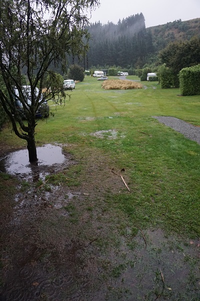
Preparing for the trail was hard enough. We would have to carry everything we needed for the next three days. Since the weather forecast was mixed, this included a wide range of clothing from shorts and sunhat to fleeces and waterproofs. Food wise, we had to buy a portable stove as there are no cooking facilities in the huts. Then we had to plan meals which would be light and portable – whilst highly nutritious, of course!  Finally, we had to buy sleeping bags as no bedding is provided in the huts. We went as cheap as we could on the sleeping bags, since we don’t have the baggage allowance to take them back to the UK – but then we discovered that Night 2 was forecast to be 9 c and the sleeping bags are only supposed to be warm enough for temperatures of 10 c and above – would they keep us warm or would we freeze??

nzb2

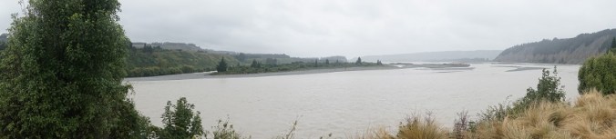
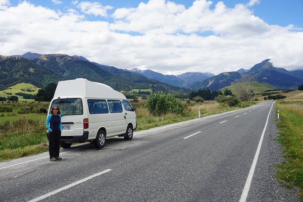
To get to Motueka, the nearest town to the start of the trail from Hanmer Hot Springs was a challenge. I suggested we cut across to Kaikoura on the East coast, stay the night there and then take the highway to Picton and then on to Motueka on the South Coast road. We went all the way over a slow and twisty mountain pass to reach Kaikoura – then discovered that due to damage from Cyclone Gita, the highway to Picton was closed.

nzb4

So the next day we had to drive all the day back over the slow and twisty turny mountain pass – straight back to Hanmer Hot Springs. After that we had another three hundred kilometres to cover before we reached Moteuka. Two long days of driving. On the plus side, Kaikoura was pretty – and we saw some awesome scenery, including some snow capped peaks!

nzb1

As we approached Moteuka, we started to see lots of wineries and another interesting looking crop which we realised was hops. There were also plenty of veggies for sale by the side of the rode. The range was amazing – from apples and pears to lemons and pomegranates. We stopped and brought a huge bag of apples for $2 (about one pound) – delicious! There were some other intriguing signs on the road to Moteuka which we didn’t have time to follow up. One read:

Theatre – Art Gallery – Tame Eels

Tame Eels??? If anyone knows what that is about, let me know! On reaching Moteuka, David did spot a huge eel swimming along in a stream –  but as far as I know, it wasn’t tame!

Day One


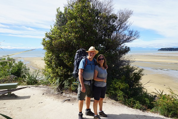
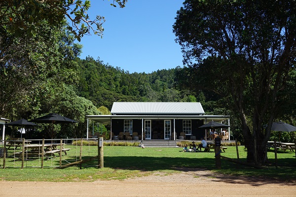
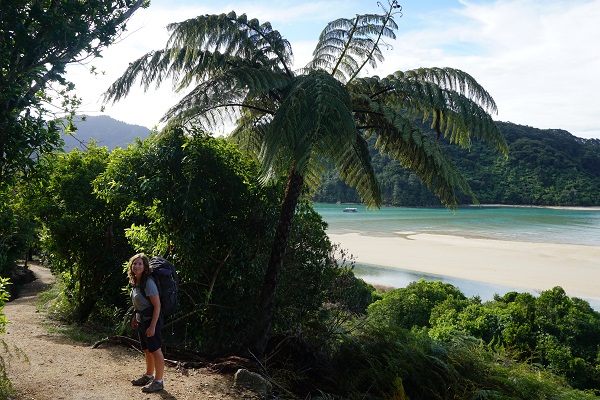
The day of The Great Walk dawned bright and clear. After some last minute checks – suntan lotion? Check! Mosquito repellent? Check! – we headed to Marahau, which is at the start of the trail. We parked the camper van in the car park of the Abel Tasman water taxi company. The car park is provided by the water taxi company. It’s free, as long as you book with them to pick you up at the end of the walk.  As soon as the van was parked, we shouldered our backpacks and set off. David was worried his pack felt too heavy, but mine felt just right and my confidence soared. We only had 12 kilometres to cover today. Maybe it was going to be okay.

nzb10

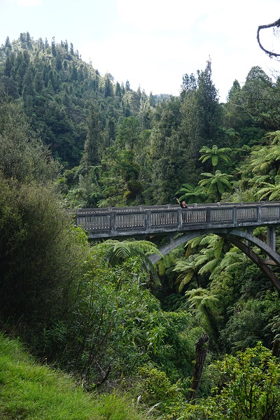
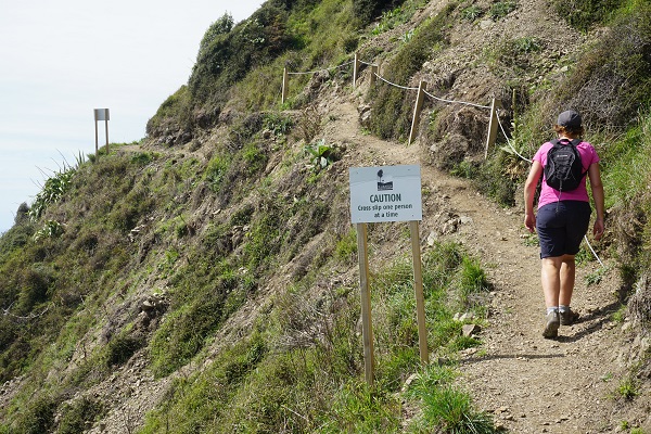
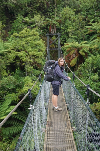
Immediately, two things happened to unsettle me. First, we met a girl who stopped us to ask if we knew where she could hire or buy a camping mat. This set me wondering if the huts provide mattresses for the beds. Perhaps we’d be sleeping on bare boards that night…? Second, the bridge at the start of the trail had been washed away by the Cylone and we had to pick our way over a river. What other Cyclone damage would we encounter on route?

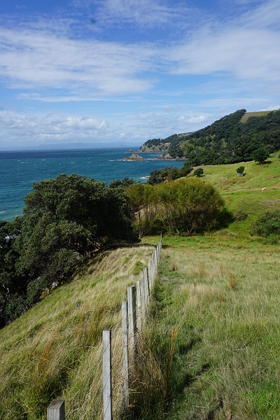
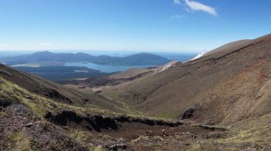
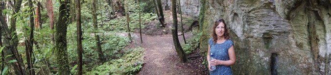
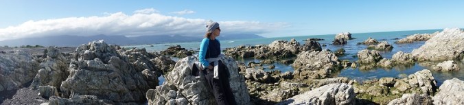
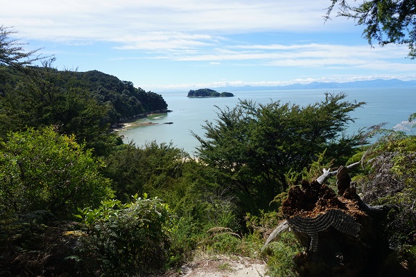
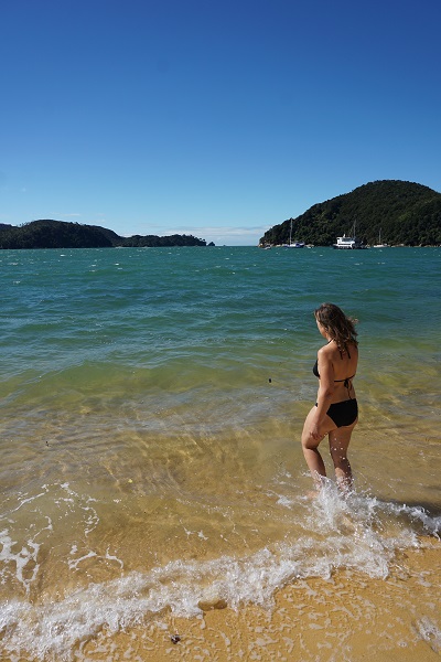
Soon, we were into the walk. We climbed up from ground level to wind our way along a path which clung to hills high above the coast. The path was really pretty. It was overhung with giant ferns and other shade giving trees and bushes. Stunning beaches were round every corner. It was tempting to go down and swim but with heavy packs on our backs, we didn’t want to go ‘off piste’ too much. Around midday, we stopped on a beach for a Scooby snack. It was hot and I was tempted to swim but settled for a paddle. There’d be time for a swim once we reached the first hut.

nzb6

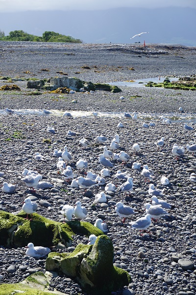
An hour later, we stopped for lunch (cheese and pickle sandwich and the inevitable apple, since you ask!) I was impressed to find toilets provided at intervals along the route, as well as taps with treated water so we could can refill our water bottles along the way. The trail was spotless, with no signs of litter. Dogs are not allowed on the trail so no dog mess, either!

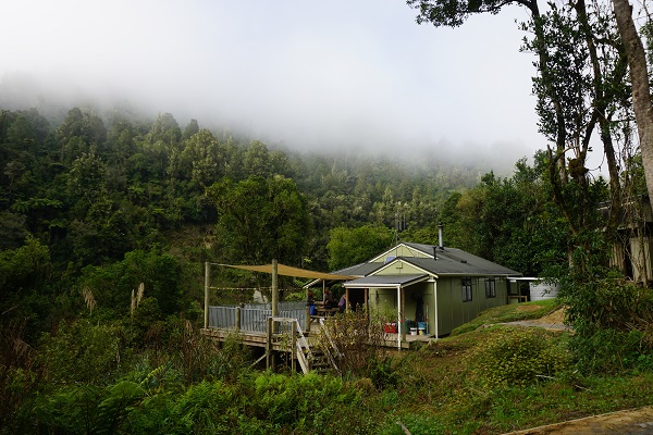
By three p.m., we reached the first hut at Anchorage. It was beautifully situated, right on the beach at Anchorage Bay. The first thing I did was get changed and go for a swim. A wind had blown up and it was quite breezy by now so it was an English style dip rather than a full blown swim. After swimming, I headed up to check out the hut. It was a lot bigger than I’d imagined. There was a large communal kitchen and dining room with a wood burning stove and four separate bedrooms with eight beds in each hut. And praise the lord, the beds had mattresses! On the downside, there was no hot water or power, except for some solar powered lights in the communal kitchen which came on after dark.

nzb8

The communal aspect took a bit of getting used to. I feared we’d end up sharing with a family with a noisy baby. Apparently, there’d been one in the night before. As it turned out we did end up sharing with a family, but they were super quiet and considerate (Shout out to Lucie, Dan and Leeia! if you are reading this)  The family are taking a gap year to travel the world and homeschooling . It was lovely to meet some other ‘Senior gap year’ travellers, albeit at a different stage in life. I was asleep by 9 pm and didn’t wake up until the sun came up. After a hearty bowl of porridge we hit the road again for the start of Day Two.

Day Two

This was going to be our hardest day at almost 20 kilometres. That may not sound much, but with a pack on, believe me, it is a long way, particularly when the route is as up and down as this one was.

nzb7

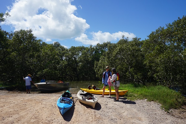
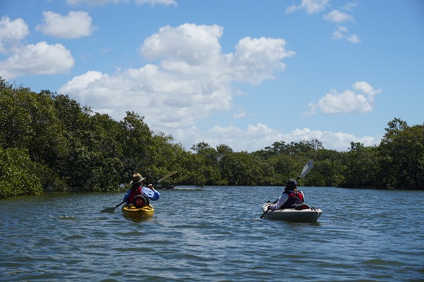
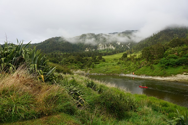
A light rain began to fall around midday. We reached Bark Bay Hut an hour later, moments before it really started to come down. This was the half way point. Since we were booked into huts at either end of the walk, we felt we were entitled to go inside and eat our lunch inside the hut. Someone had lit the fire and it was lovely and warm. As the downpour intensified, a group of kayakers pushed into the hut, dripping wet. We felt really lucky to have bagged a place to sit. One of the kayak party organisers pushed through carrying a burning hot pot of soup and scalded someone. After this incident, we decided it was time head off and make space for someone else. Fortunately the rain was letting up.

nzb9

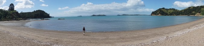
II have to confess, the afternoon felt very long. The rain continued in fits and starts. Both of us started to develop aches and pains in various different places – backs, feet, shoulders. I swear the hills became steeper. The rest breaks were certainly more frequent. Then at about 5.30 pm, the weather began to clear. By the time we arrived at Aworoa Hut an hour later, it was beautiful. And so was the hut. It was smaller and more basic than the one at Anchorage, but in a stunning secluded location. It faces Aworoa Bay, which has to be crossed to reach the rest of the trail. It can only be crossed around low tide. Low tide was at 2 pm the next day, which meant we would have to hang out at the hut until just before 1 pm, by which time the water should be low enough to cross.

nzb12

Inside the hut, the fire was lit and a washing line was hung with coats, sleeping bags and bags. Not everyone had been as lucky as us and dodged the rain. Sleeping wise, the arrangements were basic – three rooms with twelve beds in each, six on the bottom bunk and six on the top, all lined up in a row. All very cosy, but not necessarily conducive to a good night’s sleep!

We ate food, stared at the view and played cards until such time as we could decently go to bed – about 9.30 p.m. It was hard to sleep. Far from being too cold, it was actually too hot, due to the fire in the next room. People seemed to be climbing over me and skipping in and out of bed for the next couple of hours. Then at 2 a.m., a group of super fit, macho lads got up to try and make a night time crossing of Aworoa Bay, which woke me again.  Restless, I went outside. The lads had already gone. The moon was bright enough to light up the entire bay.

Day 3

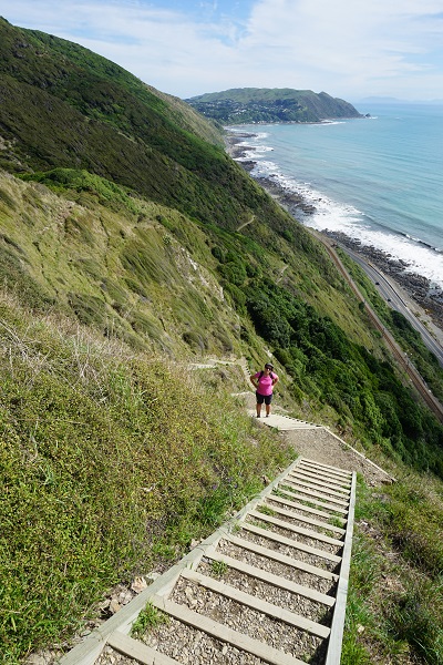
A warm, cloudy day. We hung around until just before 1 pm waiting to cross Aworoa Bay. By midday, a sense of restless excitement filled the hut – there were a dozen people who just couldn’t wait to cross the bay. Some of them set off early. It was funny watching them wade out into the bay, the water climbing higher and higher, but I’m pleased to report that everyone made it over. Finally it was 12.45 and we decided to go for it. Shorts on, packs on the back, bare feet. It was pretty uncomfortable, crunching clam shells with every step, but there was no danger of being washed away –  the water stayed below the knee.

nzb11.jpg

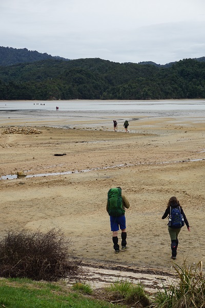
Once we were on the other side, we had to pick up the pace as we had two hours until our water taxi departed and a sign stated that it was a two hour and five minute walk. If we missed it, there were no other boats that day. So, ignoring all the aches and pains, we stomped up and down the hills without a break, and made it to the beach in plenty of time.

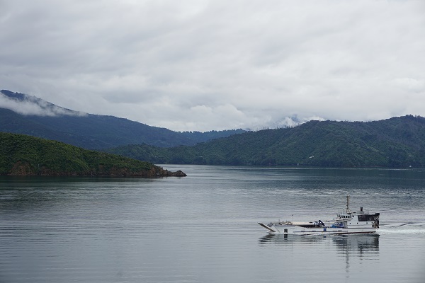
Getting onto the water taxi turned out to be the biggest challenge of the entire walk. By this time, a wind had got up and the sea was surprisingly rough. One elderly man wobbled as his pack swayed on his back and ended up taking a swim. When it came to my turn, I eagerly accepted the Captain’s offer to carry my pack out to the boat for me. Even so, I ended up soaked to the waist. David didn’t fare any better. By the time the boat set off, we were freezing. There was a big swell and the boat was over crowded. However, despite these drawbacks, the Captain was determined to give us a tour of the local sights. We saw some New Zealand fur seals and their pups, which was cool, but by this stage we just wanted to get back on dry land. Finally, we arrived back at Marahau. Instead of pulling onto the shore, we drove straight onto the back of a trailer which was pulled by a tractor. Then we were driven back to the car park perched in the boat! It was such a relief to get back to the campervan and change out of our wet things. We were pie eyed with exhaustion but filled with a great sense of achievement. We had completed our first Great Walk!

nzb5


A state of emergency in Christchurch, New Zealand

nza3

Our first few days in New Zealand have been…interesting. Interesting to say the least. I have to confess, there have been a few times when I’ve asked myself, why didn’t we stay in sunny Sydney…?

It all started as we stood in line to pick up our campervan. We were in Christchurch, which is on the East Coast of South Island. An information board read ‘if you don’t know about Cyclone Gita, ask us!’ I didn’t know about Cyclone Gita – so I asked. And discovered that an evil Cyclone had wreaked havoc on Tonga and was now making a beeline for New Zealand, with torrential rain, floods and sea surges expected. A quick Google revealed that upper and central South Island was due to be worst hit, which is where we were. It seemed odd, as the weather outside was lovely. But over the next three hours – we had to wait in line for three hours to pick up our campervan – the weather deteriorated and by the time we hit the road, it was raining. We decided to abandon our plans to go North and headed South instead. We picked an inland campsite in Rakaia Gorge. On the way down, we stopped off at a supermarket and stocked up on enough food to keep us going for at least three days – just in case we ended up stranded or the roads were closed.

nza1.jpg

I’d like to tell you what Rakai Gorge was like, but the truth is, I didn’t see much of it. By the time we arrived at the campsite, the rain was torrential and visibility poor.  The site was basic with no wifi and no electric hook up so we couldn’t find out what was happening with Cyclone Gita. All we could do was cook some food and try to keep warm. As soon as it got dark, we climbed into bed. Miraculously, we slept well, but after spending seven weeks in tropical temperatures, we woke up feeling the cold.  The weather was wet and windy but nothing worse (yet!) so we drove back to Christchurch to pick up some supplies.

The first shop we hit was a camping store where we stocked up on  waterproofs, thermal underwear and sleeping bags. David tracked down a cheap mobile phone for use in New Zealand and a couple of torches. Now we felt ready for Hurricane Gita! We went to a café and checked the latest news reports.

The news was not good.

It seemed that since we came into Christchurch, a state of emergency had been declared. It was expected to flood badly. Other things had got worse – flights were no longer coming into New Zealand and ferries between South and North island were cancelled. Tourists were being advised to seek shelter and keep off the roads.  Hearing all this, we left Christchurch swiftly and headed back to Rakaia Gorge for another night, dodging the odd flooded road. The site was looking worse for wear, with large areas of grass flooded and most of the other campers gone. Despite the new purchases we were still cold and still unable to find out what was going on. Overnight the campervan was battered and buffeted, but we woke up to find we were all in one piece.

nza2

It was still raining cats and dogs. What to do? Sit it out for another night or take the risk of driving further North to a campsite which might offer something more than a cold, wet night indoors?

We took the risk and headed North to Hanmer Springs. Hanmer Springs is a small town which is best known for its thermal springs. Arriving in Hanmer Springs, the terrible weather continued but with some improvements.  The campsite had a kitchen, which gave us somewhere reasonably warm to eat and cook. And there was wifi!  We could let our families know we were still alive. Best of all there was a pub within walking distance. It was warm, and they had live music and beer, so we found a table and settled in for the night.

nza5

The next morning we woke up to find that the rain had stopped – hallelujah! We checked news reports and found that the Cyclone had not caused as much damage as feared. A few roads were closed, and some rivers flooded but that was about it. We headed down to the hot springs and as soon as it opened, we were in. It was wonderful to lounge about in the slightly smelly sulphurous spa water, at temperatures of 38-40 c.  As well as the various pools, there were three ‘flume’ rides which we couldn’t resist. The weather steadily improved, and soon the sun came out, chasing our ‘Cyclone’ blues away. I think New Zealand might be okay after all…


waterslide2